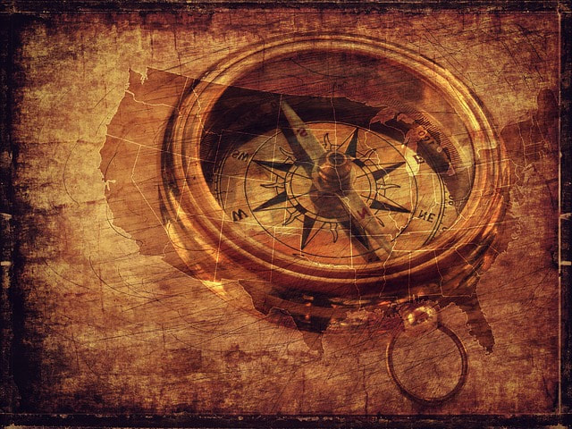
Bearings - Where You Going? How to get there? What to see?
QUOTE: “A map is the greatest of all epic poems. Its lines and colors show the realization of great dreams.” ~
Gilbert H. Grosvenor, Editor of National Geographic (1903- 1954)
“You can't get there from here, and besides there's no place else to go.”
― Sheldon B. Kopp, If You Meet the Buddha on the Road, Kill Him: The Pilgrimage Of Psychotherapy Patients
* * * * * * * * * * * * * * * * * * *
A Favorite Maine expression: "You cahn't get theyah from heah, deah! "
Translation: You can't get there from here, but you can if we show you a better way to get there. Confused???
This page will explain how to "Get your bearings"
That means how to figure out one's position or situation relative to one's surroundings.
For example, She's still new to the company and needs time to find her bearings,
or I'll be along soon; just wait till I get my bearings.
In Maine, that means figuring out where you want to go and how you're gonna get there,
and how to understand what the folks are sayin' there, bub!
Click any item shown in green, which is an active link to open a description and location.
Below are explanations of Maine navigation and terminology
Portions of Wesley Porter's Fishing Journey and subsequent manhunt were in the areas of
BAXTER STATE PARK and
Maine's New National Monument KATAHDIN WOODS and WATERS
maps of both locations at the bottom of the page
NAVIGATION TERMINOLOGY
|

|
|
UNORGANIZED TERRITORY in MAINE
Maine has many TOWNSHIPS, which are unorganized areas not large enough to be a town or city. Townships may have names or may simply be designated by a township and range identification, such as T3 R4 WELS or T5 ND BPP. T stands for township, and R indicates a range. Townships are subdivided into SECTIONS. Since each township is six miles by six miles, township contains 36 square miles, each one forming a section. WELS is an abbreviation for “West of the Easterly Line of the State,” referring to the north-south line in Aroostook County. There are MANY other township designations and abbreviations. The map below shows Townships in light green, and Baxter State Park is the dark green area. 
Color Map of Maine Townships, courtesy of Maine Encyclopedia - Townships.
EO AND GPS COORDINATES
Are measurements of latitude and longitude in Degrees, minutes, and seconds (DMS): 41°24'12.2"N 2°10'26.5"E GEOCODE is the GPS coordinates (or the latitude and longitude) of a physical address. Global Positioning System (GPS) is a worldwide radio-navigation system formed from the constellation of 24 satellites and their ground stations. How to express Latitude and Longitude How to find a place with coordinates with Google maps How did we navigate before GPS and cellphones? Oh My! It's easy, we used either "dead reckoning" (using time, direction and speed) previous travels (if you've been to a place before, you know how to get there again, don'tcha? In earlier years in Maine, we used a map and compass and knew where true North and magnetic north and where Polaris the North Star is. There are several map aids to navigation: Road Maps - Shows cities, towns, interstates, highways Topographic maps - Called for short a TOPO map, it shows elevation, depth and steepness of geological features Tide charts at sea So, you got a nice new map? Thank the USGS, the US Geological Survey, a group of scientists devoted to the study of biology, geography, geology, and hydrology and continuously measure and map the entire earth. Should you ever decide to hike the Appalachian Trail, which starts in Georgia and ends in Maine, you'll need to know map navigation to make it safely thru the 100 Mile Wilderness. 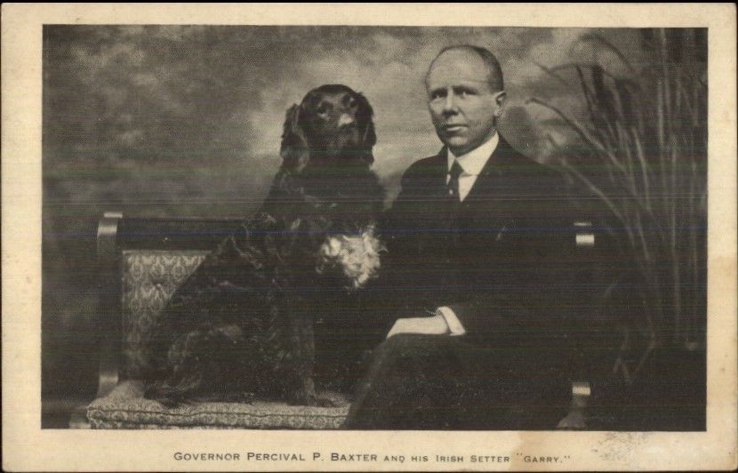
Vintage Postcard of former Maine Governor Percival Baxter and his trusty Irish setter Garry. He generously granted the land known today as Baxter State Park, and his cremains are scattered in the Park.
|
Vertical Divider
|
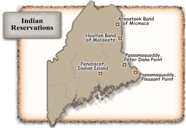 Map of Maine Reservations by Location
Courtesy of Heritage in Maine. Map of Maine Reservations by Location
Courtesy of Heritage in Maine.
MAINE GEOGRAPHIC NAMES
Many Maine towns, counties, rivers, lakes and mountains were named by five First Nations Native Americans tribes of THE WABANAKI CONFEDERACY "Wabanaki" means "People of the First Light" Language is somewhat based on Algonquin Members of the Wabanaki Confederacy are:
to Abenaki are interchangeable with Penobscot. The distinction varies by region. Many of First People of Maine share common language roots. AREAS NAMED BY FIRST NATIONS PEOPLE Katahdin - The Greatest Mountain (Penobscot tribe) Piscataquis - At the river branch (Abenaki tribe) Matagamon - Far on the other side (Abenaki) Allagash River - Bark Shelter (Abenaki) Chesunkook Lake - At the principal outlet (Abenaki) Aroostook River - Beautiful river (Mi'kmaq) Ripogenus - Gravel (Abenaki) Seboomook - Shape of Moose Head - (Mi'kmaq) Pamola - Bird God of Thunder & Bad Weather - (Penobscot) Alomkik - Pamola's Prison on Katahdin (Penobscot) Nesowadnehunk - Swift Stream between mountains (Abenaki) Penobscot - Descending ledges (Penobscot) from a mispronunciation of their name Penawapskewi MAINE NAMES YOU WILL ENCOUNTER IN THIS STORY Chamberlain Lake while many think it is named for former Maine Governor and civil war General Joshua Lawrence Chamberlain who led the 20th Maine Regiment at Little Round Top, Gettysburg, Chamberlain Lake is apparently named for an earlier descendant, a son of Spencer Chamberlain Eagle Lake an interesting fact-Eagle Lake flows North also Town of Eagle Lake The town was named by a body of troops heading from Bangor to the Aroostook War for the many eagles that they saw around the lake Eagle Lake Tramway In a testament to Maine ingenuity and became the eastern terminus for Eagle Lake and West Branch Railroad in 1927. The tramway was a small railroad pulled by a six thousand foot cable loop. Steel trucks attached to the cable carried logs across a three thousand foot passage between Eagle and Chamberlain Lakes at the rate of about three miles per hour. The Tramway area is now on the National Register of Historic Places. The Patten Lumbermen’s Museum has in its collection a set of two of the Tramway's trucks and clamps mounted on a wooden structure, as it would have been in operation. Ghost Trains of the Allagash Abandoned 100-year old steam locomotives located in the Allagash Wilderness formerly part of the Eagle Lake and West Branch Railroad |
BAXTER STATE PARK MAP KATAHDIN WOODS AND WATERS NATIONAL MONUMENT
Neither map to scale, basically shows the road map for Baxter State Park and the proximity of Katahdin Woods and Waters Monument

Baxter State Park Road Map Courtesy of Baxster State Park
|

Illustration from Portland Press Herald newspaper showing proximity of Katahdin Woods and Waters National Monument.
|
